User Showcase: Bennett & Williams
MVS allows us to effectively communicate with project members having different backgrounds such as geologists, hydrogeologists, environmental engineers, and computer programmers, and with our clients who are less familiar with subsurface structure and groundwater modeling. MVS plays a key role in this process and I regard it as a “must have” product for any complex environmental studies that require not only accurate scientific results, but also realistic visualization and presentation.
The visualization shows the results of a wellhead protection program, groundwater flow model studying a municipal well field in central Ohio. Bennett & Williams Environmental Consultants, Inc. developed the model using an integrated modeling and calibration process to delineate the one and five-year capture zones for a 3.9 million gallon per day well field. The well field draws from a sand and gravel aquifer in a buried valley system. To simulate the complex conditions, MVS was used to develop a five-layer model incorporating complex boundary conditions and material parameters.
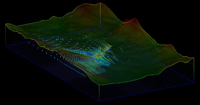
The modeling results supported a ground water monitoring program to evaluate the potential that an existing groundwater contamination plume could migrate into the well field capture zone. The calibrated model and MVS were used to evaluate various scenarios under different pumping conditions.