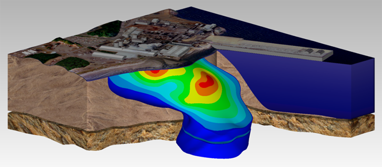
Earth Volumetric Studio (Studio) is the revolutionary synthesis of C Tech’s Environmental Visualization System and Mining Visualization System integrated with new technology from years of EnterVol development. Earth Volumetric Studio retains the modular toolkit paradigm of its predecessors in an updated, user friendly environment.
Earth Volumetric Studio is a standalone Windows program which offers the ultimate in speed, power and flexibility. Studio unites advanced volumetric gridding, geostatistical analysis, and 4D visualization tools into a software system developed to address the needs of all Earth science disciplines. The graphical user interface is integrated with modular analysis and graphics routines which can be customized and combined to satisfy the analysis and visualization needs of any application. Studio can be used to analyze all types of analytical and geophysical data in any environment (e.g. soil, groundwater, surface water, air, noise, resistivity, etc.). Earth Volumetric Studio’s integrated geostatistics provides quantitative evaluation of the quality of your data and site models and identifies locations that require additional data collection.
Earth Volumetric Studio includes the capabilities of C Tech’s former Environmental Visualization System Pro and MVS (Mining Visualization System) within a more powerful, easy-to-use environment. Features include: borehole and sample posting; parameter estimation using expert system driven 2D and 3D kriging algorithms with best fit variograms; exploding geologic layers; finite difference and finite element modeling grid generation; advanced gridding; comprehensive Python scripting of virtually all functions; high level animation support; interactive 3D fence diagrams; multiple analyte data analysis and integrated volumetrics and mass calculation for soil and groundwater contamination and ore bodies. Our advanced features, formerly found in our MVS software are targeted to the needs of mining engineers and planners, or the geologist or environmental engineer with the most demanding requirements. Some of the advanced features include: 3D fault block generation; tunnel cutting; advanced texture mapping; mine pit modeling; visualizing and modeling of ore body overburden; and many additional advanced features.
Studio includes C Tech’s DrillGuide© technology which applies integrated geostatistics to provide quantitative appraisal of the quality of site assessments and identification of optimal new sample locations at sites that require additional investigation. This proven technology can dramatically cut site assessment costs whether you’re searching for gold or groundwater contamination. Our tools improve site assessment and enhance your ability to analyze and present data for assessments, remediation planning, litigation support, regulatory reporting, and public relations.

